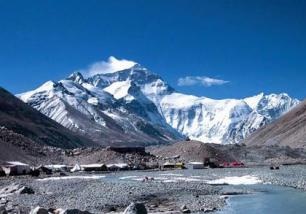
  Those who have only heard about the scenic beauty and awesome terrains around Mount Everest but never got an opportunity to get there, here is your chance to experience all that with Google Maps takes you to the Everest Base Camp, where expeditions stage their attempts to reach the top of the world.
On can have the glimpses of the snow-capped Himalayan mountain peaks and the awesome Khumbu glacier.
The Khumbu Glacier is located in the Khumbu region of northeastern Nepal between Mount Everest and the Lhotse-Nuptse ridge. With elevations of 4,900 m (16,100 ft) at its terminus to 7,600 m (24,900 ft) at its source, it is the world's highest glacier.
The Khumbu Glacier is followed for the final part of the trail to Everest Base Camp. The start of the glacier is in the Western Cwm near Everest. The glacier has a large icefall, the Khumbu Icefall, at the west end of the lower Western Cwm. This icefall is the first major obstacle and among the more dangerous on the standard south col route to the Everest summit.
The official Google blog says that the route to Everest Base Camp is one of the most popular trekking routes in the Himalayas and is visited by thousands of trekkers each year
Google has used simple lightweight tripod and digital camera with a fisheye lens to capture these scenes.
“This is typically used for our Business Photos program” the blog said.
Not only this the Google Maps brings you other most famous mountains on Earth, including Aconcagua (South America), Kilimanjaro (Africa), and Mount Elbrus (Europe) These mountains belong to the group of peaks known as the Seven Summits the highest mountain on each of the seven continents.
For Latest Updates Visit : http://www.facebook.com/pages/TelecomTiger/429104257149437 |